
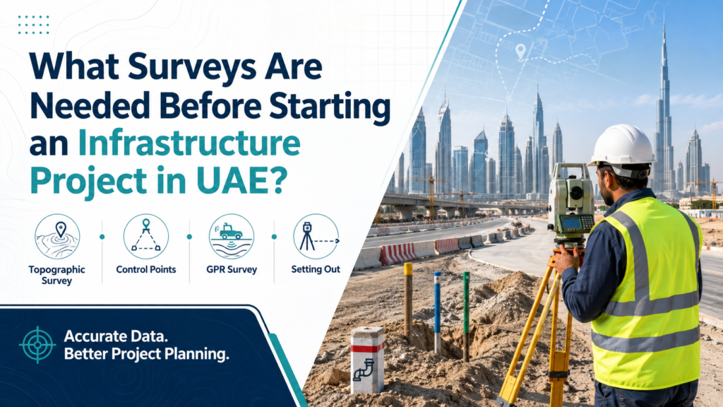
Roads, utility corridors, pipelines, rail projects and large civil developments depend on accurate site information long before construction equipment begins working on the ground.
One wrong alignment, an unidentified underground service or an unreliable reference point can create problems later during excavation, installation or construction.
That is why understanding the surveys needed before infrastructure construction in UAE is important for contractors, consultants and project teams.
Different projects require different survey activities, but most infrastructure work begins with a combination of site mapping, control establishment, setting out and underground utility verification.
Here is a practical look at the main surveys to consider before construction begins.
1. Topographic Survey Before Design and Construction
A topographic survey provides an accurate picture of existing site conditions.
It records features such as:
- Ground levels
- Existing roads
- Buildings and structures
- Kerbs
- Drainage features
- Utility structures
- Boundaries
- Surface features
- Changes in terrain
Design teams use this information when planning road levels, drainage networks, utility corridors and other infrastructure elements.
For linear projects, topographic data can also help engineers understand how the proposed alignment interacts with existing ground conditions.
Arabian Survey Engineering provides land and engineering surveys for projects requiring accurate site information before detailed construction activities begin.
2. Control Point Establishment
Before a contractor can accurately set out a road, utility line or structure, the project needs reliable reference points.
Survey control points provide fixed coordinates and elevations from which future measurements are taken.
Without a properly established control network, different teams may work from inconsistent references, increasing the risk of alignment and level errors.
Control points are especially important for:
- Highways
- Long road corridors
- Pipelines
- Railway alignments
- Drainage networks
- Utility installations
- Large development sites
For projects requiring permanent horizontal and vertical references, control point establishment can be carried out using suitable GPS/GNSS surveying methods.
3. Road and Alignment Setting Out
Once the design has been approved, surveyors transfer the engineering coordinates from drawings onto the actual site.
This process is commonly known as a setting out survey.
For a road construction survey, setting out may include:
- Road centerline
- Road edges
- Kerb lines
- Medians
- Roundabouts
- Junctions
- Formation levels
- Slopes
- Culverts
- Bridge locations
- Drainage alignments
Accuracy matters because even a small deviation at one point can affect the alignment further along a long corridor.
For this reason, setting out should be tied to verified survey control rather than temporary or unconfirmed site references.
4. Underground Utility Survey Before Excavation
One of the biggest risks during infrastructure construction is working around services that cannot be seen from the surface.
Existing underground utilities may include:
- Electrical cables
- Water pipelines
- Sewer lines
- Telecom ducts
- Gas pipelines
- Stormwater systems
- Irrigation lines
- Unknown buried services
Authority drawings can provide useful information, but they may not always represent the exact current position of every underground service.
An underground utility survey helps project teams verify existing conditions before excavation starts.
This is especially important when construction involves road widening, trenching, utility replacement or installation of new services.
5. GPR Survey Before Digging
Ground Penetrating Radar is commonly used to investigate subsurface conditions and locate buried features.
A GPR survey in UAE can support infrastructure projects where contractors need more confidence about what lies beneath the proposed excavation area.
Depending on site conditions and survey requirements, GPR can help identify buried pipes, ducts, cables, voids and other subsurface features.
Arabian Survey Engineering includes underground utility detection and Ground Penetrating Radar within its infrastructure construction survey services.
The best time to identify a potential underground conflict is before excavation equipment reaches the area.
6. Right-of-Way Survey
Infrastructure projects often extend across long corridors.
Roads, pipelines, utility networks and similar developments may need to remain within a defined Right-of-Way, commonly referred to as ROW.
A right of way survey can help teams confirm:
- Corridor boundaries
- Proposed alignment
- Existing features within the corridor
- Possible encroachments
- Utility positions
- Construction limits
Clear ROW information is particularly useful when several contractors, services or construction activities are operating within the same corridor.
It gives project teams a consistent spatial reference for planning and execution.
7. Utility Setting Out
Locating existing utilities is only one part of the work.
New utilities also need to be positioned correctly.
Surveyors may be required to set out proposed:
- Water lines
- Sewer lines
- Drainage networks
- Telecom routes
- Electrical services
- Gas pipelines
- Irrigation networks
The survey team transfers the approved coordinates and levels to the site so installation crews know exactly where the proposed service should be constructed.
For gravity systems such as drainage and sewer lines, elevation and slope control are particularly important because the service depends on the designed gradient.
8. Level and Formation Checks
Road and infrastructure construction does not depend only on horizontal position.
Levels matter just as much.
Surveyors may check:
- Excavation depth
- Formation level
- Subgrade level
- Road base
- Finished road level
- Utility invert levels
- Drainage slopes
- Embankment levels
These checks help construction teams verify that each stage is being completed according to the approved design.
Incorrect levels can affect drainage performance, pavement buildup and connections between different sections of a project.
9. Earthwork and Volume Surveys
Large infrastructure projects frequently involve excavation, filling and movement of significant quantities of material.
Survey data can be used to compare surfaces and calculate quantities for:
- Cut and fill
- Excavation
- Backfilling
- Stockpiles
- Embankments
- Progress measurements
For projects where quantities need to be monitored throughout construction, measurement surveys can support earthwork calculations and progress verification.
This information can also help contractors and consultants compare actual site progress against planned quantities.
10. As-Built Survey After Installation
Surveying does not stop when an infrastructure element has been constructed.
An as-built survey records the actual final position and level of completed work.
Depending on the project, it may document:
- Road alignment
- Kerb positions
- Manholes
- Pipelines
- Utility chambers
- Drainage lines
- Structures
- Levels
- Installed services
The resulting drawings allow project teams to compare what was constructed against the approved design.
As-built information can also become important later when maintenance teams, authorities or future contractors need accurate records of existing infrastructure.
When Should Infrastructure Surveys Start?
Survey planning should begin before major site activity starts.
A typical sequence may look like this:
- Review available project drawings and records.
- Complete the required topographic survey.
- Establish or verify project control points.
- Locate existing underground services.
- Confirm the Right-of-Way or construction corridor.
- Set out proposed alignments and levels.
- Carry out ongoing construction checks.
- Measure earthworks where required.
- Complete as-built surveys after installation.
The exact sequence will depend on the project type and consultant requirements.
What matters is that survey activities are integrated into the construction program rather than requested only after a site problem appears.
Which Projects Need Infrastructure Construction Surveys?
Infrastructure surveying can support a wide range of civil engineering works, including:
- Road construction
- Highway projects
- Rail projects
- Utility corridors
- Sewer networks
- Stormwater drainage
- Water pipelines
- Gas pipelines
- Telecom networks
- Power infrastructure
- Bridges and culverts
- Industrial developments
Long linear projects are particularly dependent on reliable survey control because alignment errors can become more significant over distance.
Do You Need a Full-Time Survey Crew?
Some projects require only specific survey visits.
Others need surveyors on site continuously for setting out, level checks, coordination and as-built work.
Projects with frequent daily surveying requirements may benefit from a dedicated team rather than arranging individual mobilizations.
Arabian Survey Engineering also offers survey crews for hire on different contract durations for construction and infrastructure projects.
The appropriate setup depends on project duration, workload and how frequently field verification is required.
Questions Contractors Should Ask Before Survey Work Starts
Before beginning an infrastructure project, confirm:
- Which coordinate system is being used?
- Which benchmarks are approved?
- Have project control points been verified?
- Is current topographic information available?
- Have underground utilities been checked?
- Is GPR required before excavation?
- Has the ROW been confirmed?
- Which elements require setting out?
- Who will approve survey outputs?
- How frequently are as-built records required?
Resolving these points early can reduce confusion between contractors, consultants and survey teams during construction.
Infrastructure Surveying Should Begin Before the Problem
Infrastructure projects involve many interconnected elements.
Road geometry affects drainage. Utility corridors interact with existing services. Levels determine whether gravity networks function correctly. Every construction team also needs to work from the same reliable spatial reference.
That is why the surveys needed before infrastructure construction in UAE should be considered part of project planning, not simply a site activity that happens after construction begins.
For road, rail, pipeline and utility projects, Arabian Survey Engineering provides infrastructure construction surveys in UAE covering setting out, Right-of-Way and underground utility investigation.
For project-specific requirements, you can also contact Arabian Survey Engineering and share your project location, drawings, required survey scope and expected construction schedule.
Frequently Asked Questions
What survey is needed before road construction?
Road projects commonly require a topographic survey, control point verification, alignment setting out, level checks and investigation of existing underground utilities.
Why is a GPR survey required before excavation?
GPR can help identify buried features and utilities before excavation, reducing uncertainty about subsurface conditions.
What is setting out in infrastructure construction?
Setting out is the process of transferring coordinates, alignments and levels from approved engineering drawings onto the physical construction site.
What is a Right-of-Way survey?
A Right-of-Way survey helps establish or verify the limits and alignment of a road, pipeline, utility or other infrastructure corridor.
Are authority utility drawings enough before excavation?
Existing records are useful, but site verification may still be required because actual utility positions or undocumented services can differ from available drawings.
When is an as-built survey carried out?
As-built surveys are generally completed after installation or construction to record the actual final position, dimensions and levels of completed infrastructure.