
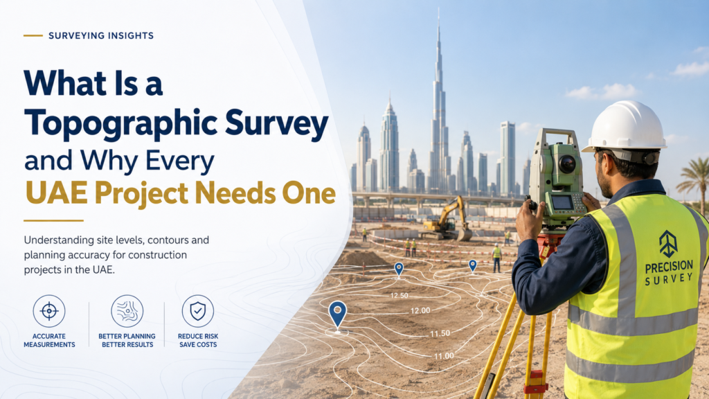
Before an architect draws a single wall or an engineer calculates a single cut-and-fill volume, someone has to answer a basic question: what does the ground actually look like right now?
That answer comes from a topographic survey — and skipping it, or rushing it, is one of the most expensive mistakes a UAE construction project can make.
What Is a Topographic Survey?
A topographic survey is a detailed record of a site’s physical features and elevations, captured exactly as they exist on the ground. It covers:
- Levels and contours — the rise and fall of the land, shown as spot heights and contour lines
- Existing structures — buildings, boundary walls, fences, and hardscaping already on site
- Natural features — trees, vegetation, and ground cover
- Infrastructure — roads, utility covers, manholes, poles, and drainage points
- Boundaries — property lines tied to official survey control
All of this is delivered as an AutoCAD drawing and a digital terrain model, built to the accuracy and format your consultant expects to see.
Why Every UAE Project Needs One
1. Design Decisions Are Only as Good as the Data Behind Them
An architect designing floor levels, a civil engineer routing drainage, or a landscape designer planning grading — all of them are working from assumptions unless a topographic survey has already mapped the real ground conditions. Get the levels wrong at the design stage, and the error doesn’t stay small; it compounds through every drawing that follows.
2. It Prevents Costly Site Surprises
Unmarked utility lines, an unexpected slope, a boundary that doesn’t match the title deed — these are the kind of surprises that stall a project mid-construction. A proper topographic survey catches them before the first excavator arrives, not after.
3. Consultants and Authorities Expect It
In the UAE, municipality approval processes and consultant reviews are built around accurate baseline data. A topographic survey that’s been captured by municipality-approved surveyors and delivered to the right format tends to pass review without the back-and-forth that a rushed or inaccurate survey invites.
4. It Feeds Directly Into Other Survey and Design Work
A topographic survey isn’t a standalone deliverable — it’s the starting point for almost everything downstream. The same terrain data supports earthwork volume calculations for grading and cut-and-fill planning, and it’s tied back to the control points that keep every later survey — structural, MEP, or construction — accurate to the same reference system.
How a Topographic Survey Is Carried Out
Modern topographic surveys combine several instruments depending on the site’s size and terrain:
- GNSS RTK (satellite positioning) — fast, accurate coverage for open sites and large land parcels
- Robotic Total Stations — precise point-by-point measurement, especially where GNSS signal is obstructed
- Drone photogrammetry — rapid coverage of large or hard-to-access areas, producing dense point clouds and orthophotos
The right combination depends on the site — a single villa plot doesn’t need the same approach as a few hundred hectares of open land.
When You Need a Topographic Survey
- Before submitting a design to a UAE municipality for approval
- Before finalizing architectural or civil engineering drawings
- Before any grading, drainage, or earthwork planning
- Before subdividing or developing a land parcel
- Before renovation projects where existing ground levels affect the new design — often paired with an existing building or structure survey when structures are already on site
Topographic Survey vs. Other Site Surveys
It’s easy to confuse a topographic survey with a measured building survey or a construction setting-out survey. The distinction is straightforward:
- Topographic survey — maps the land itself: ground levels, contours, and existing features
- Measured building survey — documents an existing structure’s exact dimensions and layout
- Construction survey — sets out design positions on site during building, often using infrastructure construction survey methods for roads, utilities, and site works
Most projects need more than one of these at different stages — but the topographic survey almost always comes first.
What to Look for in a Topographic Survey Company in the UAE
- Municipality-approved surveyors whose drawings pass consultant review the first time
- Modern equipment — GNSS RTK, robotic Total Stations, and drones rather than outdated methods
- Fast mobilization, since site access windows are often tight
- Experience across project types — villa plots, large land parcels, industrial and energy sites
Arabian Surveying Engineering LLC runs topographic surveys across all seven Emirates, using the same equipment and instruments trusted by consultants for structural, MEP, and infrastructure work — so the same team that maps your site can carry that data through the rest of the project.
Get Your Site Mapped Accurately
Whether it’s a single plot or a large land parcel, a topographic survey is the foundation every other drawing depends on. See the full range of land and engineering surveys we offer, or get in touch directly.
Call +971 55 360 5092 or Contact us to schedule a site visit.