
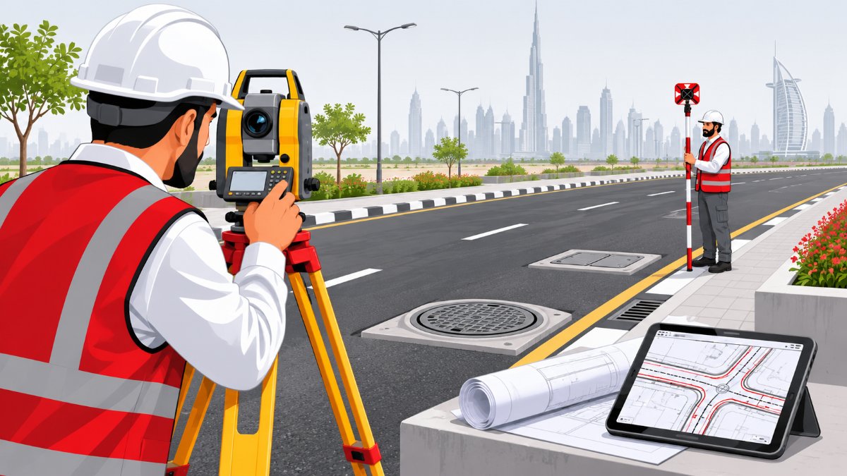
Drawings show what was meant to be built. An as-built survey shows what was built. On a UAE project the gap between the two is normal, and it is not a failure: pipes move around a clash, a kerb shifts to meet an existing road, a column is cast a few centimetres off its grid. What matters is that someone measured it, wrote it down, and handed it over. That record is the as-built survey in the UAE, and this guide explains it for roads, utilities and structures.
If you are looking for mechanical and electrical records, we cover those separately in our article on the MEP detail survey. Here the focus is the civil and structural side of handover.
What an as-built survey actually is
An as-built survey is a measured record of completed work, taken after construction or at agreed stages, showing the real position and level of what now exists. The surveyor compares it with the design and reports the differences. The output is usually a CAD drawing, a coordinate and level list, and sometimes a short comparison report.
It is not the same as a topographic survey, which records the ground before design, and it is not the same as setting out, which places work before it is built. It sits at the end of the chain and closes it.
When you need one
- At handover: the client or the authority asks for proof of what was built before accepting the work.
- Before covering up: buried pipes, ducts and cables are far cheaper to measure while the trench is open.
- For stage payments: progress is agreed from measured positions and quantities.
- For future works: the next designer needs a reliable base for extensions or maintenance.
- When disputes arise: a dated, measured record settles most arguments quickly.
Requirements for formal submissions vary by authority and project. Check with the relevant authority and your consultant what format and content are required, and tell your survey company before the work starts.
As-built surveys by type of work
Roads
For a finished or part-finished road the surveyor records the edges, kerb lines, centreline, crossfalls, junction geometry, signs, markings and the cover levels of chambers in the carriageway. Levels are taken at regular intervals and at every change in grade. The drawing then shows the achieved line and level against the design.
Underground and surface utilities
Pipes and cables should be surveyed before backfill. The surveyor records the position and invert or top-of-pipe level at each change of direction, joint, valve and chamber, along with pipe size and material noted by the site team. If the trench was already closed, locating methods such as electromagnetic tracing or ground penetrating radar can help, though they are less exact than measuring an open trench. Our infrastructure construction surveys cover the setting out and verification that lead up to this record.
Structures and plots
For buildings and other structures the as-built survey records the footprint, column positions, slab levels, wall lines and key openings. On a plot it also shows where the finished work sits relative to the boundary and to nearby structures. If your building is under construction, see how the earlier building construction surveys feed into the final record.
How the process runs
- Agree the scope: which elements, what accuracy, what drawing format and which coordinate system.
- Check control: the surveyor confirms the control points still agree with the original network.
- Measure on site: total station and GNSS are chosen by site conditions. Work is best done before covering up or paving.
- Process and compare: points are drawn, then compared with the design, with differences flagged.
- Deliver and review: drawing, point list and comparison are sent and checked by the engineer.
Common mistakes that cause rework
- Calling for the survey after the trench is backfilled, when it could have been measured in minutes.
- Using a different coordinate system from the design drawings.
- Not agreeing which features are in scope, so something important is missing from the drawing.
- Waiting for the last day before handover, leaving no time to correct differences.
- Changes made on site that were never recorded, so the drawing and the ground disagree.
Checklist before you order the survey
- Design drawings and the latest approved revisions in CAD.
- Coordinate system, datum and level reference confirmed.
- List of elements to be measured: roads, kerbs, chambers, pipes, structures, boundary.
- Dates when trenches or works will be open and accessible.
- Required drawing format and any layer standard from the client or authority.
- Contact on site for access and for any unrecorded changes.
What the deliverables usually look like
A typical as-built package has three parts. The first is a CAD drawing with the surveyed features on separate, clearly named layers, so the designer or the client can switch elements on and off. The second is a point list with coordinates and levels, which lets anyone check or reuse the data. The third, when asked for, is a comparison showing where the built position differs from the design and by how much.
Ask for the files in the format your consultant or the receiving authority works with, and agree the layer naming at the start. It is much easier to set this up before the survey than to reorganise a finished drawing at the deadline.
How accurate does it need to be?
There is no single answer. The accuracy needed depends on the element and the specification: a gravity drain invert level needs far tighter tolerance than the edge of a landscaped verge. Read the specification, or ask the engineer, and give the survey company the figures. A surveyor can choose the right method and instruments once the target is known, and can tell you honestly if the target is tighter than the site allows.
Equally important is repeatability. If the as-built is tied to the same control points as the original setting out, anyone can later check the result against the same reference. That is another reason we recommend keeping one control network through the whole project, from the first peg to the final drawing.
Frequently asked questions
Is an as-built survey the same as a final inspection?
No. An inspection judges quality. An as-built survey measures position and level. The two support each other, and the engineer uses the survey to judge whether work is within tolerance.
Can you survey a road that has already been opened to traffic?
Often yes, with traffic management arranged by the project team. Work in live lanes needs safe access, so tell the survey company about the traffic situation in advance.
Who pays for correcting differences?
That is a contractual matter between the parties. The survey only reports facts and does not decide who is responsible.
Can you provide the work for sites outside Ras Al Khaimah?
Yes. Our registered office is in Al Khuzam, Ras Al Khaimah, and we work across Dubai, Sharjah, Abu Dhabi and the whole UAE.
Get your handover record measured
Arabian Surveying Engineering LLC has been surveying UAE projects since 2017, with ISO 9001:2015 certification and more than 500 projects behind us. To discuss an as-built survey, call +971 55 360 5092, email info@arabianse.com or write through our contact page.