
Most plot disputes do not start with a dramatic argument. They start with a fence built a metre too far, a foundation that crowds a neighbour, or a site plan that nobody checked against the ground. A plot demarcation survey in Dubai exists to prevent exactly that: it takes the boundaries written on paper and marks them, physically and accurately, on the land you own or are about to build on.
This guide explains what demarcation actually involves, when developers and contractors need it, how the process usually runs, and what to prepare so the work goes smoothly. It is written for plot owners, contractors and project managers, not for surveyors.
What Is a Plot Demarcation Survey?
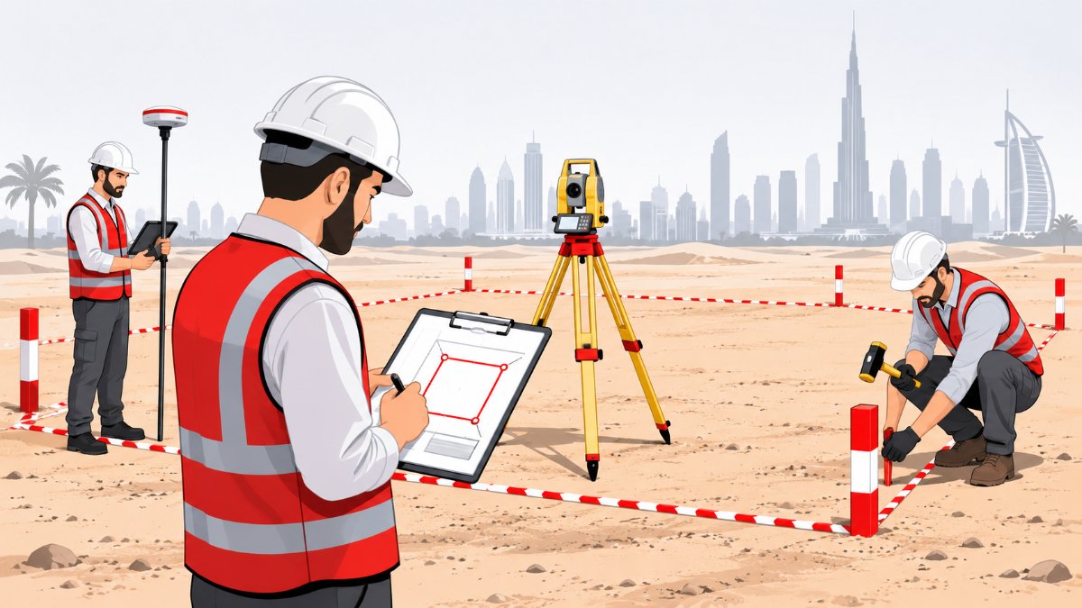
Demarcation is the act of locating and marking the corners and boundary lines of a plot on site, based on the registered plot data. A surveyor works from the approved coordinates and plot plan, measures from established control points, and places visible markers (pegs, nails or painted points) at each corner. The result is a clear, checkable boundary that everyone on the project can see.
It is different from a topographic survey, which records what is on the land (levels, structures, features). Demarcation answers a simpler but more important question: where exactly does my plot start and end? If you want to understand the difference in more detail, our guide on hiring a topographic survey company in the UAE covers the topographic side.
When Do You Need One?
- Before starting excavation or foundation work on a new plot
- When you buy or take handover of a plot and want to confirm its corners on the ground
- Before building a boundary wall or fence
- When neighbouring plots are being developed and the shared boundary must be agreed
- After site clearing or earthworks that may have removed existing markers
- When a dispute or doubt about a boundary needs an independent record
In Dubai, plot and survey matters are linked to Dubai Land Department (DLD) requirements, so it helps to use a survey company that is approved by DLD. The Arabian Surveying Engineering LLC is an approved survey company with Dubai Land Department. For any specific submission or approval step on your plot, always check with the relevant authority, because requirements can differ by community and project.
How the Demarcation Process Usually Works
1. Collect the plot documents
The surveyor needs the plot number, the approved plot plan or title documents and the boundary coordinates. Having these ready at the start avoids the most common delay.
2. Establish or check control
Accurate marking depends on reliable reference points. The team either uses existing control in the area or sets up new points. Our control point establishment service uses static and RTK GPS methods for this stage.
3. Set out the corners
Using GPS RTK and total station methods, the crew calculates each corner position and marks it on the ground. Each marker is checked against neighbouring points to confirm distances and angles agree with the plan.
4. Verify and record
Good practice is to measure the marked boundary back and compare it with the plan, then record the final coordinates. This record is what you hand to your contractor and keep on file.
5. Hand over clear deliverables
Ask for the marked corners on site, plus a drawing or coordinate list showing every point. If you want boundaries tied into the wider project, the same crew can continue with building construction surveys such as setting out the structure.
Common Problems a Demarcation Survey Prevents
- Encroachment: a wall or foundation that crosses into a neighbouring plot
- Setback errors: a building placed closer to the boundary than the approved plan allows
- Lost markers: old pegs removed by earthworks or vehicles
- Rework cost: demolishing and rebuilding something that was set out from the wrong line
Catching a boundary issue before concrete is poured is far cheaper than finding it during handover. For larger developments, boundary marking is often the first of several survey stages, and the full range of our survey services can follow on from it, including land and engineering surveys.
Practical Checklist Before You Book
- Plot number, community name and approved plot plan
- Title or ownership document, and any affectation or site plan you hold
- Name of the project contractor and the person who will be on site
- Site access details, including gate permissions and working hours
- Whether old markers, fencing or temporary structures are still on the plot
- What you need at the end: marked points only, or a drawing and coordinate list too
- Any approval or submission you must make to the relevant authority afterwards
Choosing a Survey Company for Demarcation
Look for a company that is approved to work in your emirate, can explain its method in plain language, and checks its own work. Ask how the markers will be verified and what you will receive in writing. Since 2017 we have supported over 100 clients on more than 500 projects across Dubai, Sharjah, Abu Dhabi, Ras Al Khaimah and the rest of the UAE, and we are ISO 9001:2015 certified, which means our process is documented and audited.
Frequently Asked Questions
What is the difference between plot demarcation and a topographic survey?
Demarcation marks the legal boundary of a plot on the ground. A topographic survey records existing levels and features inside and around it. Many projects need both, in that order.
Do I need demarcation if the plot already has a fence?
A fence is not proof of the boundary. If you are unsure that it sits on the correct line, a demarcation survey will confirm it before you build against it.
How long does plot demarcation take?
It depends on plot size, access and the state of existing control points. A survey company can only give a realistic estimate once it has seen the plot documents and site conditions.
Does demarcation need approval from an authority?
Rules vary by community and project, so check with the relevant authority before you start. A DLD-approved survey company can guide you on what documents to prepare.
Talk to Our Survey Team
If you need your plot boundaries marked accurately before you build, our team is ready to help. Call +971 55 360 5092 or email info@arabianse.com, or use our contact page to send your plot details.