
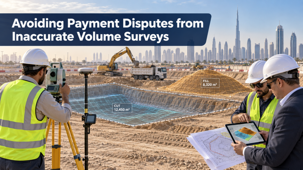
A contractor submits an interim payment certificate for 500,000 m³ of excavated material. The consultant’s numbers come back 2% lower. That gap sounds small until someone converts it: 10,000 m³ of disputed material, sitting between the contractor and their money. Payment disputes from inaccurate volume surveys happen more often than most project teams expect. They rarely come down to dishonesty — they come down to measurement error that nobody caught in time. Firms delivering measurement surveys see this pattern repeat across earthwork, stockpile, and progress claims alike.
Where Volume Disputes Actually Come From
Most disputes trace back to one of a few root causes:
- No original ground survey before excavation started, leaving no reliable baseline to measure against
- Mismatched survey methods between contractor and consultant . One uses Total Station, the other drone photogrammetry, and the two datasets don’t reconcile cleanly
- Weak control points underneath the survey, which shift every volume calculation built on top of them
- Inconsistent measurement intervals, where monthly progress surveys skip a period and force estimation to fill the gap
Each of these is preventable. None of them show up as a problem until a payment certificate gets challenged, by which point the excavation has already happened and there’s no going back to re-measure the original surface.
Why the Baseline Survey Matters More Than the Final One
Every volume calculation compares two surfaces: where the ground started, and where it ended up. If the starting surface was never properly surveyed, every claim afterward rests on an assumption instead of data. This is why a pre-work topographic survey matters so much — it’s the one measurement that can’t be recreated later. Once an excavator has moved earth, the original surface is gone, and any dispute about the starting point becomes a matter of argument rather than evidence. A solid control point network underneath that baseline survey protects the accuracy of every measurement that follows.
Matching Methods to Avoid Reconciliation Problems
Volume disputes often aren’t about who’s wrong — they’re about two valid methods producing slightly different numbers. A Total Station survey and a drone photogrammetry survey of the same stockpile can legitimately differ by a small margin due to how each captures the surface. The fix isn’t picking the “more accurate” method in isolation — it’s agreeing on a single method with the client or consultant before work starts, and sticking to it for the life of the project. Consistency between surveys matters more than which specific method wins on paper.
Building a Paper Trail That Holds Up
A volume number without documentation is just an opinion. A defensible claim includes:
- Certified coordinate data tied to a verified control network
- Cross-sections and surface models showing exactly how the volume was calculated
- A clear record of survey dates, so monthly progress claims can be traced and audited
- Consistent software and computation methods used across the whole project, not switched mid-way
This is the same documentation discipline that protects building construction surveys and infrastructure construction surveys from disputes over completed quantities, not just earthwork.
What to Agree on Before the First Shovel Moves
The best way to prevent a dispute is to remove the ambiguity before work starts. Before excavation begins, contractor, consultant, and surveyor should agree on:
- Which survey method will be used for baseline and progress measurements
- How often progress surveys will run, and who’s responsible for scheduling them
- What tolerance is acceptable between contractor and consultant figures before it’s flagged as a discrepancy
- Who holds the original ground survey data, and how it’s shared and verified
Projects that settle these questions upfront rarely end up in a dispute later — the numbers already have an agreed process behind them.
When a Dispute Does Happen
If a discrepancy surfaces despite good planning, the fastest resolution usually comes from re-checking the control network first, not re-arguing the volume calculation. A shifted or unverified control point can explain a gap that looks like a measurement dispute but is actually a reference error. Bringing in a fresh, independent verification survey — using the original baseline data — often resolves the disagreement faster than escalating it through contract channels.
The Bottom Line
Volume disputes cost real money, and almost all of them are preventable with the right baseline survey, a consistent method, and documentation that holds up under scrutiny. Getting this right from day one is far cheaper than resolving a disagreement after the fact. See our full approach to earthwork and stockpile measurement on our Measurement Surveys page, or learn more about our team on our About page.
📞 Want to avoid volume disputes on your next project? Contact Arabian SE today to set up a reliable measurement process from day one, or browse more surveying insights on our blog.